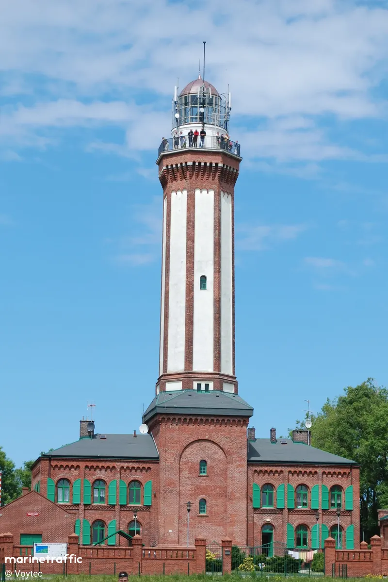
Niechorze
Περιγραφή : Lighthouse serves as one of the stations on the Polish coast coastal AIS-PL HELCOM project that allows automatic monitoring of vessel traffic in the coastal zone. Niechorskiej station antenna has a height of 65 m. The decision to build the lighthouse in Niechorze was made in 1860. Lighthouse was commissioned in December 1866. Lighthouse tower was built of brick grain. The lower part has a quadrilateral cross-section, while the upper, above the outhouses - octagon. The top of the tower is crowned with a balustrade terrace. At the top was placed laterna, which was used as the light source and camera Fresnel class.
During the war in 1945, artillery shell destroyed the Laterna, where the lamp was lit and apparatus enabling the lighthouse. Germany during the retreat founded in Building 8 of explosives that were found after the liberation of the lighthouse keepers (not had time to detonate). Lighthouse was rebuilt according to old records, and the restart followed by 18 December 1948.
In 1999, renovations were made lighthouse.
Τύπος:
Lighthouse
Τύπος Αναλαμπής:
Flashing (Fl)
Πλήθος Αναλαμπών:
1
Χρώμα Φωτός:
White / W
Περίοδος Αναλαμπής:
10s
Ύψος Φακού (Εστίαση):
63m
Εμβέλεια:
20M
Τοποθεσία / Περιοχή / Νησί:
Baltic Sea Niechorze
Έτος ναυπήγησης:
1866
Σε Λειτουργία:
Ναι
Σχήμα & Υλικό
brick
Χρώμα κατασκευής
red
Κοντινά Πλοία
| Όνομα Πλοίου | Απόσταση | Διόπτευση |
|---|---|---|
| MRZ 2 | 8.42 | 67 |
| IMPERATOR | 16.97 | 65 |
| KOL 111 KORNELIA W | 17.91 | 73 |
| NUREK 2 | 17.92 | 73 |
| ATHLON II | 17.92 | 73 |
| KORNELIA ZUZA | 17.93 | 73 |
| WLA 220 | 17.93 | 72 |
| SPARROW | 17.94 | 72 |
| MIRACULIX | 17.94 | 73 |
| EMANUEL1 | 17.94 | 73 |
| KOL 68 | 17.95 | 73 |
| KOL 40 | 17.95 | 72 |
| WLA 31 | 17.96 | 72 |
| PELICAN | 17.96 | 73 |
| CYKLON | 17.97 | 72 |
| KOL 120 | 17.98 | 73 |
| WILSON ELBE | 18.02 | 72 |
| SG 212 | 18.02 | 72 |
| KOL196 | 18.03 | 73 |
| KOL 32 | 18.03 | 73 |


